Interactive & Printable Maps.
Make Outdoor Spaces Easier to Explore and Navigate.
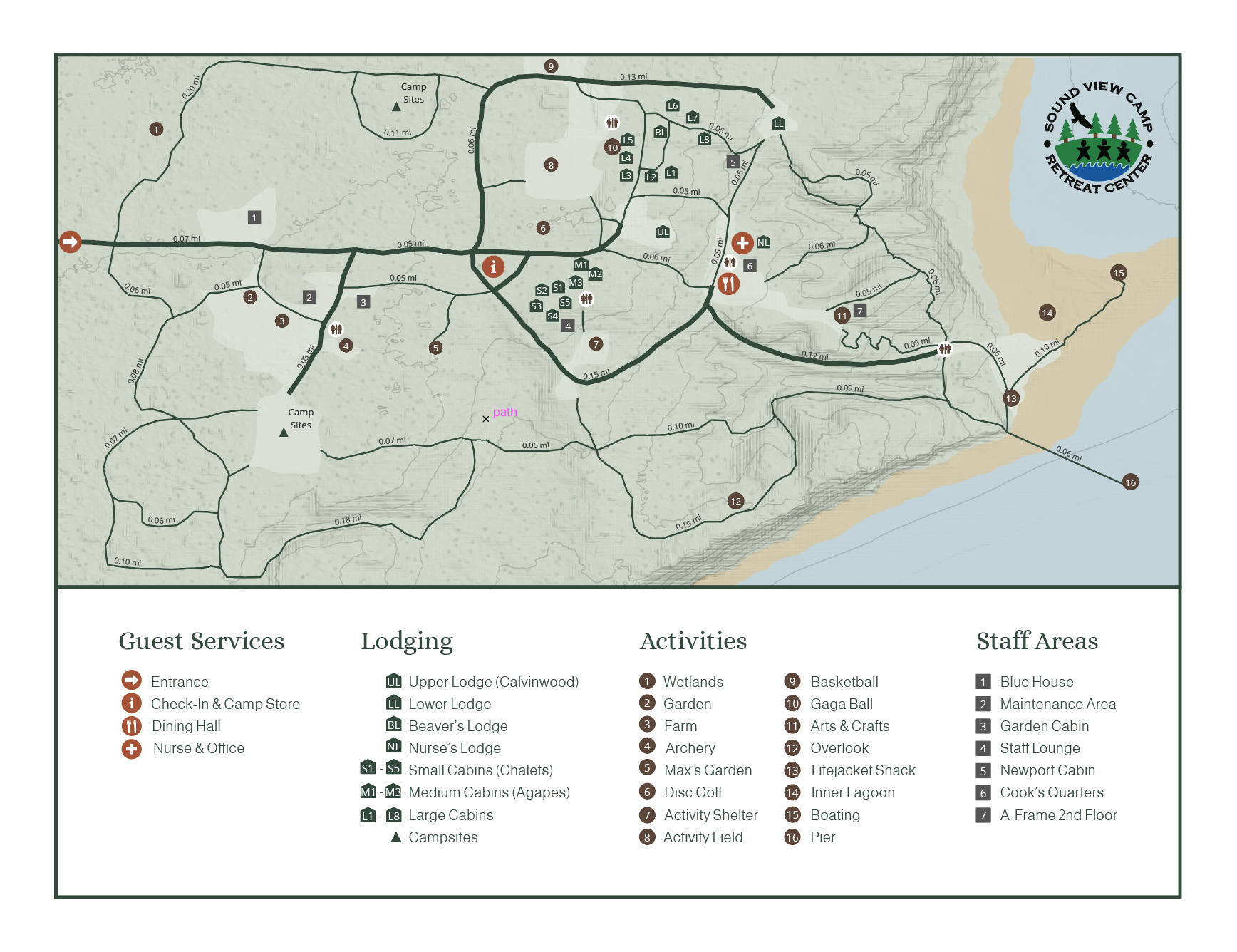
I developed interactive and printable maps for Sound View Camp and Retreat Center to help visitors navigate the 100-acre property and discover its facilities, trails, and activities. Using geographic data and QGIS, I organized complex spatial information into clear, accessible visual resources, adapting the design for both digital exploration and an 8.5 × 11-inch printed map. I established consistent symbols, colors, and labels across formats to help visitors orient themselves and plan their experiences.
Experience: Sound View Camp and Retreat Center (Board Member, Volunteer)
Interactive Map
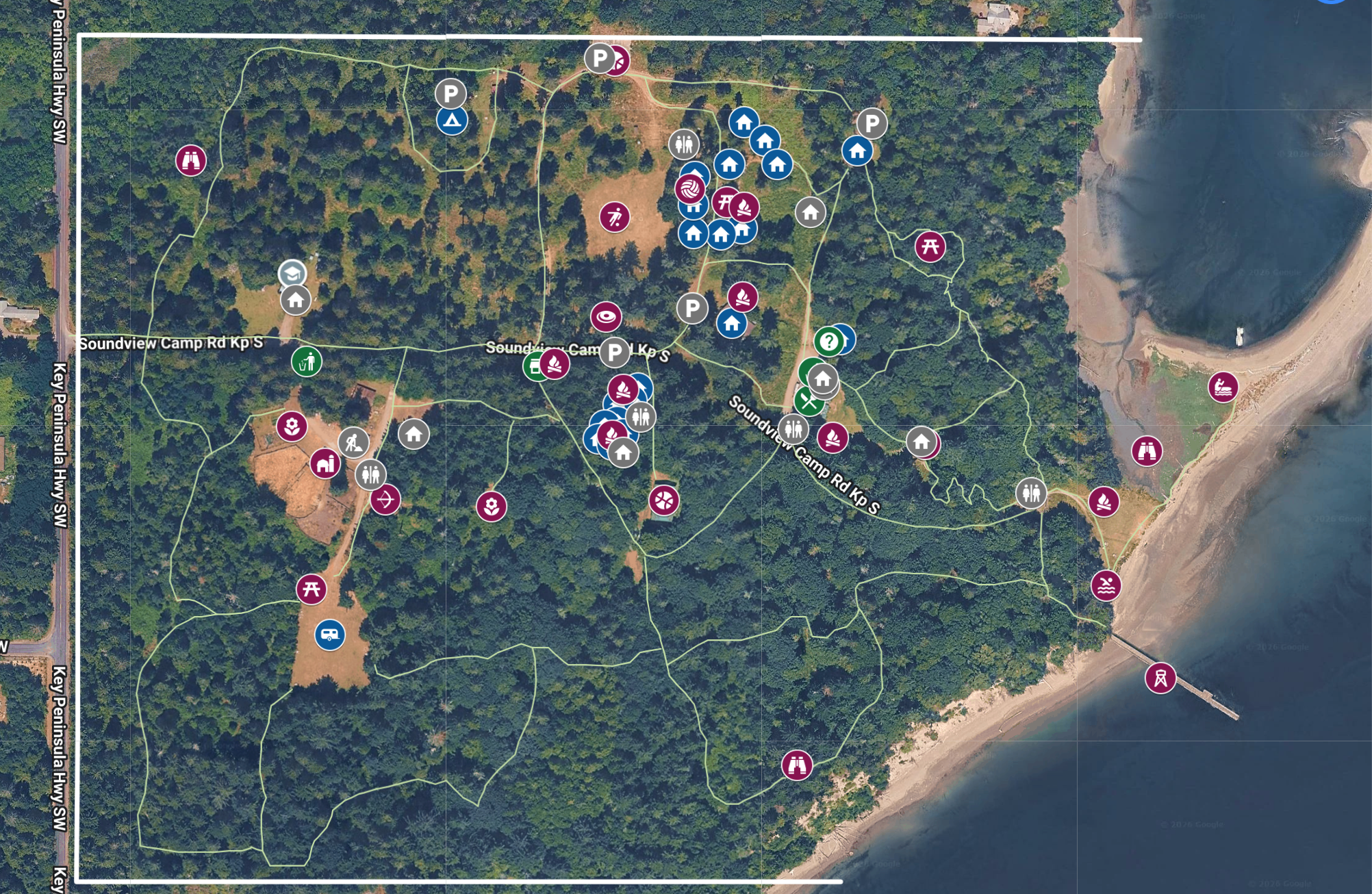
I created the interactive map using Google My Maps, organizing geographic information into distinct layers with consistent symbols and labels. The goal was to help prospective guests plan their time on site, upcoming guests set expectations about walking distances before arriving, and current guests find destinations.
The map is also viewable on mobile via Google Maps, which was an important accessibility function.
Printable Map
Before
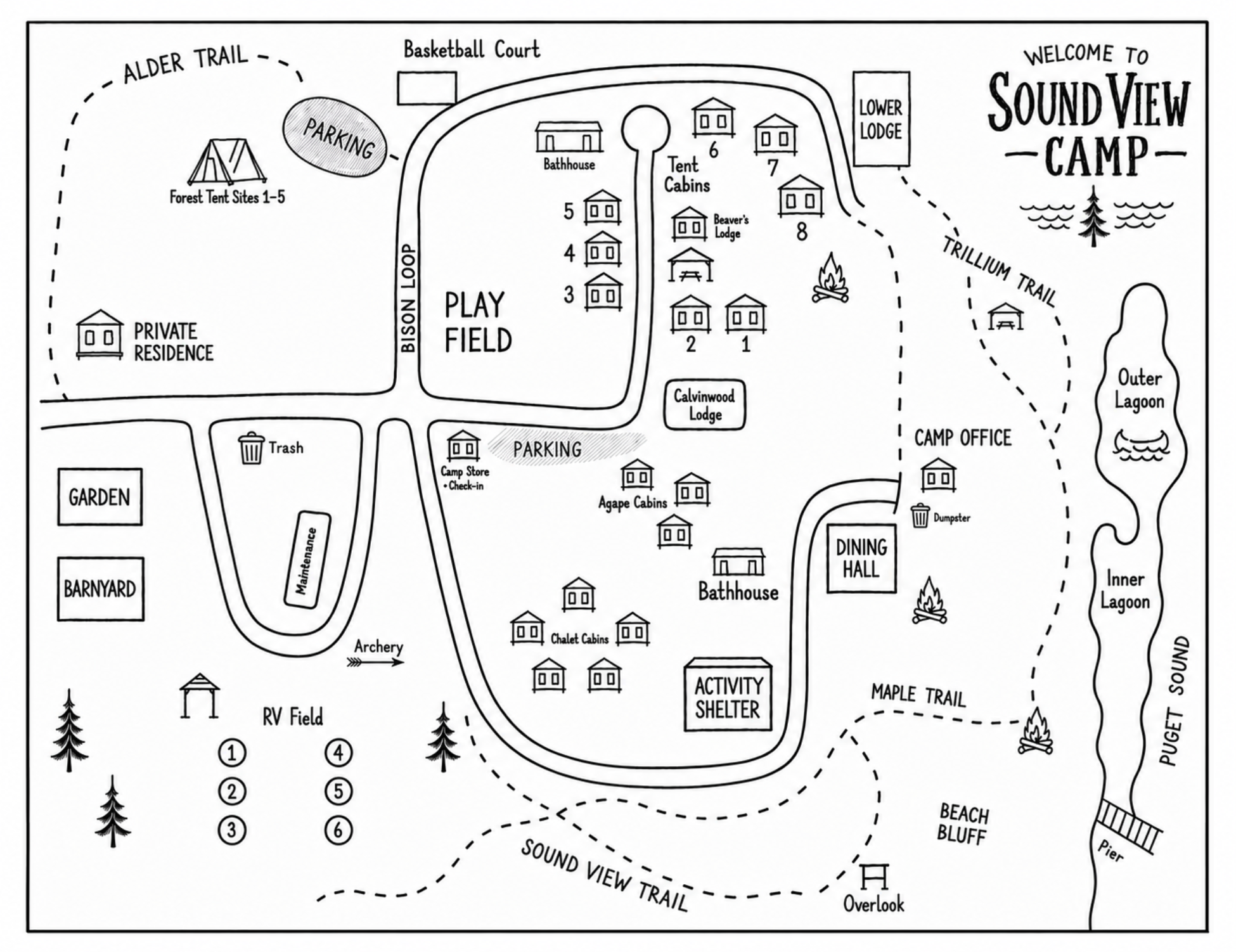
I redesigned the printable map, gathering geographic data and using QGIS to import terrain layers, in order to create a more accurate representation of the property. The updated 8.5 × 11-inch map balances detailed information with readability for practical use on site.
After